

Every year, even with my show schedule, I plan at least one trail ride. I've done that for so many years that, when August comes around, I crave it. This year was no different . . . and I knew where I was going to go. Last year, I could only get away to the Potato Range for one day with a night each end of it at Tatlayoko Lake, the starting point of the ride. Much too short and I couldn't see as much as I wanted to. "This year," I said to myself, " I'll go for three days!
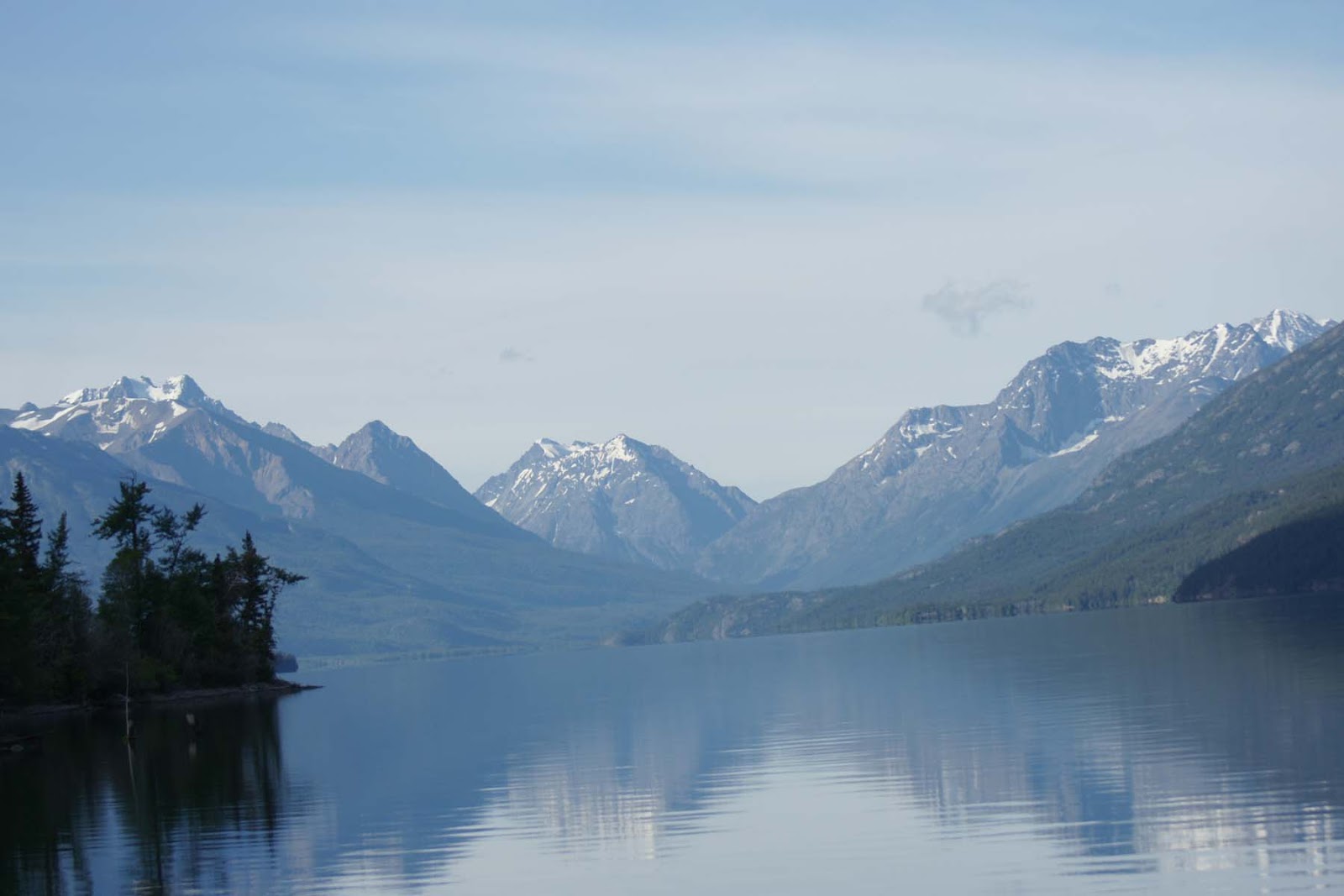 |
| Tatlayoko Lake |
But since my two "trail horses" (trained reining horses) were both in foal, I had a problem - what horse to ride . . . or pack. Undaunted, I decided Whisper could make the ride if I conditioned her, which took care of the first problem but not the second. (I didn't want to risk Legacy's foal.) Finally, I asked another woman if she would like to go with me (and supply a pack horse!). She did and we started planning.
First I needed to hone my packing skills, so I dragged out all the tack, caught Wolf, who had never been packed, and went through the process. it seems I didn't forget how and Wolf was a good sport - too bad I can't use him but taking a stallion as a packhorse is out!

On with the plan. I set dates, made lists, dug out maps, and collected items for the pack boxes. Then life got in the way. My hay supplier phoned with a number for another fellow who was going to bale small square bales. I needed those bales and haying weather is not something you take a chance on. I cancelled the ride in favour of picking up bales.
 |
| Mischa and I on top of the load. |
But now I was ticked. My head was on the Potato Trail, especially since I had been going over maps, photos and Google Earth. As I do when I am disapointed or stressed, I started playing with the capabilities of the internet and my computer. What I came up with was a few "virtual" tours of the area - with the aid of Google Earth and my GPS readings. Check these out:
This tour starts after I reached the top, a three hour ride with an elevation gain of 3500 feet. Ride along with me on the Potato Trail to Echo Lakes. I have ridden here three times - a long day ride with Crystal to find the trails (isn't that half the fun?), then with Alberta friends for 3 1/2 days in 2009, then my one-day ride last year. (Click 'play' to get started)
Another option, more of a route than a trail, is to ride the crest overlooking Tatlayoko Lake. I have been to three points on this route but have not yet ridden it in its entirety. It may be more of a hiking trail than a riding trail. I have seen enough to know it is rough, rocky, windy and there could be patches of snow. Elevation is 6500-7000 feet! Here is a tour of the crest.
From Echo Lakes, (where we camped overnight in 2009), my friends and I found a wonderful trail leading through semi-open terrrain (some without marked trails!) to the southern end of the crest route.
Well, that was fun . . . and I almost did go along for the ride. I could easily put myself on the Potato Trail as I played these tours. However, they are no substitute for the real thing. Next year nothing is going to get in my way!
Note: If you would like to see these "tours" on a bigger screen, you can view on my website under "Google Earth Tours" I hope to add some more tours of other trails in the future. http://www.wildwoodreining.bc.ca/
0 comments:
Post a Comment